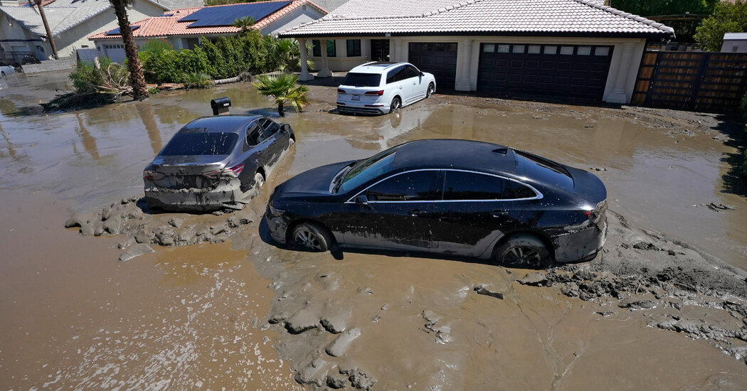
The memory of Hurricane Hilary’s rare trek toward Southern California remains fresh for many residents, serving as a reminder that the West Coast is not immune to tropical activity. As the current hurricane season progresses, meteorologists are observing a distinct shift in where these powerful storms are likely to strike. While the Atlantic Coast has enjoyed a relatively calm start to the year, atmospheric conditions suggest that the Pacific side of the country may face an elevated threat level.
What happened
Two months into the traditional Atlantic hurricane cycle, the Eastern Seaboard and Gulf Coast have remained largely undisturbed. To date, only two systems, Arthur and Bertha, have developed enough strength to receive official names. This quiet period aligns with early-season forecasts that suggested the Atlantic might see a reprieve from the high-frequency storm activity of previous years.
However, the lack of activity in the Atlantic does not mean a quiet season for the United States as a whole. Instead, the focus is pivoting toward the West Coast. Experts indicate that the current climate setup is making it increasingly possible for tropical systems to track closer to California. This creates a scenario where the Pacific could see more significant storm activity near the mainland than the historically more vulnerable Atlantic region.
Context
The primary driver of this atmospheric reshuffling is El Niño. This climate phenomenon occurs when surface waters in the central and eastern Pacific Ocean become unusually warm. These elevated temperatures act as fuel for tropical cyclones in the Pacific, providing the energy necessary for storms to grow and maintain their intensity as they move northward.
Conversely, El Niño creates a hostile environment for storms in the Atlantic. It generates increased vertical wind shear—a sharp change in wind speed and direction at different altitudes. This shear effectively acts as a barrier, disrupting the organization of developing tropical systems and preventing them from maturing into major hurricanes. While the Atlantic is suppressed, the steering currents in the Pacific are altered, occasionally opening a “corridor” that allows storms to bypass cooler waters and reach Southern California or the Desert Southwest.
Why it matters
This shift in storm distribution has significant implications for public safety and disaster preparedness. Southern California’s infrastructure and emergency response systems are generally optimized for earthquakes and wildfires rather than tropical deluges and high-wind events. As seen with recent storms, even a weakening tropical system can bring catastrophic flooding to arid regions, trigger mudslides on fire-scarred hillsides, and overwhelm drainage systems that are not designed for tropical-scale rainfall.
Furthermore, the current trend highlights the volatility of seasonal weather patterns. A quiet Atlantic can lead to a dangerous sense of complacency for East Coast residents, while West Coast residents may be caught off guard by hazards they rarely have to consider. Understanding how El Niño redistributes risk allows for better long-term planning, ensuring that resources are positioned where they are most likely to be needed as the peak of the storm season approaches.