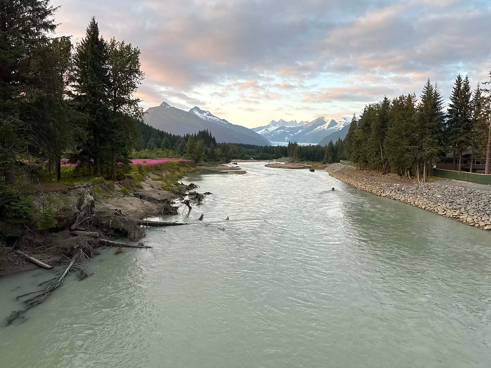
The city of Juneau is currently facing a critical environmental threat as the Mendenhall River prepares to surge toward major flood levels. Local authorities and meteorologists from the National Weather Service (NWS) have confirmed that the river is on track to reach a peak height between 16.1 and 16.6 feet on Thursday morning. Given the severity of the forecast, emergency managers have established a firm deadline for residents in designated flood zones to vacate their homes by 3 p.m. Wednesday to ensure public safety before conditions deteriorate.
What happened
According to updates from NWS Juneau, the Mendenhall River is expected to hit its peak crest between 5 a.m. and 9 a.m. on Thursday. However, the situation will become hazardous well before that window. The river is projected to surpass the “major flood stage” mark of 14 feet shortly after midnight on Thursday morning. Meteorologists expect the river to remain at this dangerous stage for approximately eight hours.
Nicole Ferrin, a warning coordination meteorologist, noted that the rate of water rise on the lake gauge is steady, indicating that the volume of water moving through the system is significant. While the Mendenhall Lake may crest at a specific time, there is a physical delay of roughly 60 to 90 minutes before the lower sections of the river reach their maximum height. To protect residential areas, the city has deployed HESCO barriers, which are large, reinforced containers filled with sand. While these are designed to hold back the flow, officials warned that a breach could trigger an immediate flash flood warning sent directly to residents’ mobile devices.
Context
The current flooding event is driven by the release of water from Suicide Basin, a glacier-dammed lake located above the Mendenhall Glacier. This phenomenon, known as a glacial outburst flood, occurs when water trapped behind ice is suddenly released into the watershed. As of Wednesday morning, monitoring equipment indicated that the basin’s water level had already dropped by 25 feet since the release began on Tuesday.
This rapid drainage of the basin serves as a precursor to the rising levels downstream. At 11 a.m. Wednesday, the Mendenhall River was measured at just over 6 feet, but the volume of water currently exiting Suicide Basin ensures a steep rise throughout the evening. The NWS and local emergency teams are monitoring these gauges in real-time to provide the community with the most accurate window for the impending crest.
Why it matters
The primary concern for Juneau’s emergency management team is the sheer speed and power of the incoming water. Ryan O’Shaughnessy, Juneau’s emergency program manager, emphasized that the window for a safe exit is narrow. If the protective HESCO barriers were to fail, the surrounding neighborhoods could be inundated within minutes. This leaves residents with very little time to react, making the 3 p.m. evacuation deadline a vital safety measure.
Safety officials have stressed that many homes in the potential flood path are single-story dwellings, which offer little protection against high-volume, fast-moving water. Because the water is expected to move with such velocity, driving or walking through flooded streets will be impossible and life-threatening. If a barrier breach occurs after the evacuation deadline, the protocol shifts to “sheltering in place” on the highest floor available. By urging residents to leave early, the Unified Command aims to move people out of harm’s way before the river reaches its most volatile state, ensuring that the community handles this natural event with a focus on safety and preparation.